Thursday, December 15, 2005

White Christmas? Be careful with early predictions

In a follow-up of the last posting, Lake Mendota didn't actually freeze on the 8th as had been suggested. Apparently the very warm fall did have enough effect. I believe the lake froze over during the early morning of last Monday the 12th, which puts it later than in 2000, but I haven't seen confirmation on exactly what day it froze.
Onto the new topic, Madison has received ample snowfall so far this December, 14.4 inches so far, way more than any other time in the last ten Decembers except for the extremely snowy December of 2000. This caused the Wisconsin State Journal a couple of days ago to write a story speculating about how a white Christmas appears very likely this year. They asked NBC-15 meteorologist David George if he thought we would have a white Christmas, and he said that it appeared almost certain.
In Madison we received a heavy, wet, 4.5 inches of snow yesterday (12/14) that packed down on top of the snow already on the ground to give a snow depth of 8 inches. With the cold weather so far this month, it would seem that 8 inches would be easily sufficient to last until Christmas, just ten days away.
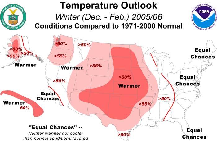
But......model runs have been hinting at a strong warmup just before Christmas for the last few days. Today, that trend has continued and become more pronounced. Long-range forecasts should always be taken with a grain of salt, but it now looks possible that we could have temperatures near 50 from the 22nd through the 25th. If so, our chances of a white Christmas would be seriously jeopardized. If all of the snow were to melt fairly early in that period, it's possible that we could have record highs on Christmas in the mid to upper 50s.

Wednesday, December 07, 2005

Lake Mendota will likely freeze tonight

If Lake Mendota freezes tonight, it would be the earliest freeze in 28 years, since the winter of 1977-1978, even more remarkable after the significantly above normal summer and fall in Madison. While unusually early by recent standards, it would only put this year in a four-way tie for 19th earliest freeze since records have been taken in 1853. It’s likely that the urbanization of the area around Lake Mendota has accounted for some of the delay of average ice-in date, but it’s questionable how much (negligible, 1 day, 1 week?).

Lake Mendota Earliest Freeze Dates

1.) Nov. 23, 1880-1881
2.) Nov. 25, 1857-1858
3.) Nov. 29, 1873-1874
4.) Nov. 30, 1872-1873
5.) Dec. 2, 1861-1862
5.) Dec. 2, 1869-1870
7.) Dec. 3, 1929-1930
8.) Dec. 3, 1976-1977
9.) Dec. 4, 1893-1894
10.) Dec. 5, 1886-1887
11.) Dec. 6, 1856-1857
11.) Dec. 6, 1926-1927
13.) Dec. 7, 1859-1860
13.) Dec. 7, 1936-1937
13.) Dec. 7, 1937-1938
13.) Dec. 7, 1942-1943
13.) Dec. 7, 1972-1973
13.) Dec. 7, 1977-1978
19.) Dec. 8, 1858-1859
19.) Dec. 8, 1864-1865
19.) Dec. 8, 1876-1877
19.) Dec. 8, 2005-2006?

Records are from the UW-Madison Limnology Department, http://lter.limnology.wisc.edu/mendota_ice.htm#recent

Thursday, November 17, 2005

Cold weather is here: will it last?

The cold weather did indeed arrive--the high today in Madison was only 20 after a morning low of 10, 20 degrees below normal. Milwaukee was not much warmer at 22 and 15. Temperatures in Madison have been 20 degrees above normal recently in both September and October, but it's been since last winter that we've seen 20 degrees below average. It looks like we'll see a bit of a warmup in the next few days, with 40s possible on both Sunday and Monday, which will probably feel very comfortable after the 20 degrees today. However, the eastern-US upper level trough that is causing our cold weather now looks like it may return by Tuesday and Wednesday, with another couple days of very cold weather possible by then. After that, the exact location of the boundary between warm weather in the west and very cold weather in the east will determine whether we're going to be warm, cool, or frigid. It looks like a good bet that in the 7-14 day time frame Colorado will be warmer than average and Maryland colder, but for Wisconsin it's still uncertain.

Wednesday, November 09, 2005

Risk of cold weather in coming week or two increasing

A very cold arctic airmass has been building in Alaska and far northern Canada over the last week. Over the first eight days of November, Fairbanks, Alaska has had an average high of 0 and average low of -13, fifteen degrees below normal for the beginning of November. So far, this very cold air has been held up by the jet stream over the far north, but that may change over the next week or two. The computer models have a difficult time forecasting weather patterns this time of year, especially the track of storm systems and the movement of very cold arctic air masses, and so a few minor changes in the flow could result in major changes to the forecast in the day five to day ten period. Depending on the evolution of the jet stream, Wisconsin could see two or more days next week with high temperatures in the 20s and a chance of snow, or the cold air could get held up and the weather could remain relatively mild. As of today, the colder scenario appears more likely.

Monday, October 17, 2005

When will the cold weather begin?

There was a cool period a week ago, October 6-10, where temperatures were a few degrees below normal, but other than that we continue to have very mild weather this month. The temperature has dipped into the 30s several times at the airport in Madison, and the first official frost was actually recorded yesterday (Oct. 16) when the airport reached 32 degrees. There are still annual flowers blooming in my neighborhood though, so it must not have been too widespread.
In Milwaukee, the temperature has not yet fallen below 40 degrees this fall, rather unusual for this late in the season but not unheard of.
After a few showers this morning, the weather should become partly to mostly sunny and warm through the middle of the week, with highs around 70 degrees. The weather will cool down later in the week with rain possible and highs falling back toward the 50s.
We know the weather is going to cool down soon, but when are we going to slide into that well-known continuously chilly and often cloudy late fall weather that is so typical in Wisconsin?
Well, since weather is not forecastable beyond about a week, it's hard to say, but the way things are going, sunny and warmish weather may keep returning off and on between cool snaps for another month or more.
Moving on past the next few weeks toward winter, according to the national climate prediction center (CPC), most of the central part of the country is likely to get an above normal winter.

However, the most reliable forecast tool, El Nino and the Southern Oscillation, or ENSO, is expected to remain in a neutral phase this winter, limiting the long-term predictability of weather patterns over North America. During times when there is a strong El Nino, or much higher than normal sea surface temperatures off the coast of Peru like in 1997-1998, the northern US is known to have much warmer than normal winters. However, in the absence of a strong El Nino, the CPC has fewer tools at their disposal to predict the climate. From reading their forecast discussion, the warmer than normal forecast for most of the western and central part of the country is due to "interdecadal trend", meaning the on average winters have been above normal for the last several years, so there is some skill in predicting an above average winter this year. In addition, warmth over the western part of the country may be somewhat amplified this winter due to a connection from warmer than normal sea surface temperatures over the subtropical Atlantic (where all the hurricanes have been forming).

Monday, October 03, 2005

Record highest low temperatures for month of October occurring

A warm, humid air mass that originated over the Gulf of Mexico has advected into Wisconsin, bringing with it very warm overnight low temperatures. Record high minimum temperatures for the day as well as possibly the entire month of October will likely be set today and tomorrow in many locations, with some record high maximum temperatures possible as well.

Records broken so far/forecast to be broken:
Madison
Mon. Oct. 3 record high min: 63 set in 1951
Tue. Oct. 4 record high min: 63 set in 1922
Record high min for month of October: 68 set on Oct. 14, 1968.
Low so far this morning (Oct. 3) in Madison: 70 - breaks record for warmest low in month of October.
Forecast low for tomorrow morning (Oct. 4) in Madison: 70.
In addition, record high max temperatures are likely in Madison today and tomorrow.

Milwaukee
Low this morning of 67 ties record high min for the date set in 1884.
The record high min for October of 70 set on Oct. 15, 1897 could possibly be broken tomorrow.

La Crosse
Low this morning of 71 breaks daily and month of October high min record of 70 set in 1884.

Green Bay
Low this morning of 69 breaks daily high min record of 62 set in 1898 and month of October high min record of 67 set on October 2, 1891.

Thursday, July 28, 2005

Much-needed rains and cooler weather

Just when our drought situation was getting bad, much-needed rains fell over southern Wisconsin nearly every day beginning Wed. July 20 and finally ending last Tuesday, the 26th. 3.46 inches fell at the airport in Madison over this period, spread fairly evenly during the seven days, entirely transforming the landscape from brown grass and hard, cracked ground, to green and moist. Although some of the rainfall events recorded in Madison were from spotty thundershowers with other areas remaining dry, almost everywhere in the southern part of the state recorded at least 2 inches of rain over the week-long wet period, with some isolated locations in Grant county in the far southwest receiving close to 10 inches.

Rainfall in Madison at the airport from July 20th to 26th:
20th: 1.17
21st: 0.75
22nd: 0.00
23rd: 0.53
24th: 0.01
25th: 0.88
26th: 0.12
Total: 3.46

Besides the end of the drought, the hot weather ended for a while as well, although highs near 90 look possible again for Sunday through Tuesday. Yesterday afternoon felt like fall though, with sunshine, low relative humidity, and a high of only 74 degrees in Madison.